Category Archives: Field Monitoring

Mule-deer Nibbled Ponderosa Tips

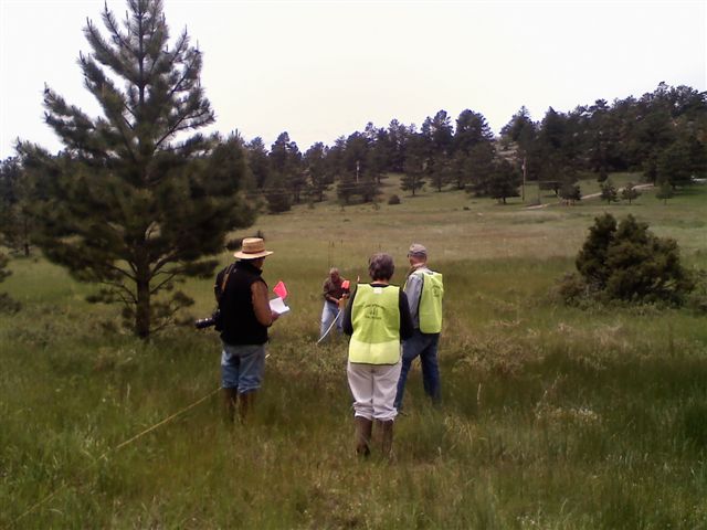
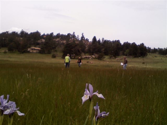
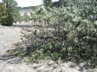
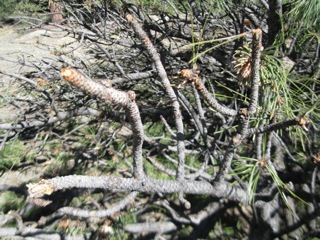
4/12/2012 Jim E sent this information along with photos, thanks Jim!  “Yesterday I happened to be walking along a game trail here in Glacier View Meadows and spotted a fairly newly wind-thrown ponderosa.  As I’d seen easily accessible branch tips nibbled on along Haystack Rd sometime ago, and didn’t know what did it, this seemed to clinch deer as the cause. The roots are extremely shallow as shown here. The trunk leading off to the left. Here’s the top of the tree showing easily reached – by deer – relatively palatable needles and branch tips.” Jim observed about a dozen piles of deer scat around the tree suggesting that deer are the culprits. He has sent an email to Mark from the Division of Wildlife to ask about mule deer forage habits.

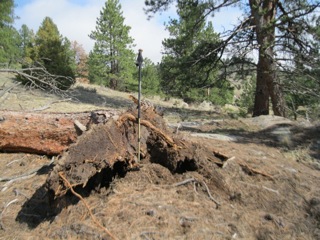
“Finally, this closeup showing a couple plants of wild candytuft (Noccaea [formerly Thlaspi] montana) growing through the pile, which must have been laid before the spring-bloom season.  I’ve Olaus Murie’s 1958 classic, A Field Guide to Animal Tracks, that includes photos of droppings.  They show the winter feeding(or dry diet), and the soft type that results from green or succulent food in summer.  Maybe your folks can tell.”

Batterson Greenbelt Survey June 21 2008

Info added 9/1/09 Because of the Houndstonque at Gate 10 discussion…more info will be forthcoming.

Who: Linda Bell, Chana Fuller and Ellen Heath spent 7 person-hours working at the Batterson Greenbelt, where Charlie Bell and Butters Fuller accompanied us.
Weather: Sunny, low 70s
Description: At the Batterson Greenbelt, we mapped (with a Garmin nuvi 650) and weeded nine sites, see Google Earth map below. Linda helped us identify penny cress (PC), tumble mustard (TM), flixweed (FW), kochia (KO), and hound’s tongue (HT) which were there along with the usual suspects: Canada thistle (CT), Musk thistle (MT) and Dalmatian toadflax (DT). This area was very diverse and a nice contrast to Crellin Lake in terms of overall species diversity.

Map Notes:
Site 1–In a 50 ft diameter area, we clipped and bagged PC that had gone to seed, pulled or hand weed whacked KO, FW, and TM
Sites 2,3,4,6 — These were four test areas Linda Bell had flagged (last year?) to study the effects of stripping the leaves off of DT to weaken them. The numbers on the map indicate the number of plants in each 20 foot diameter area. Linda and Chana stripped the leaves in a downward motion.
Site 5 — This 50 ft diameter site had 100s of TM that we weed whacked before giving up.
Site 7 — We identified a 100 ft diameter area of disturbed soil as a weed hotspot that should be sprayed. The site had it all: CT, MT, HT, PC, F AND it is above Judd and Linda’s property. See photo.
Sites 8, 9 — These two sites are riparian areas with CT, MT.

Linda Bell’s Notes:

On June 24, 2008 Linda Bell emailed “Thanks Ellen for your very comprehensive notes and pictures. Just wanted to follow up with my own list of invasive plants from the reference names used in Weeds of the West. Cheers. Linda

Discussed, identified, not managed:
Stinging nettles
Canada thistle
Field bindweed
Smooth scouringrush (equisetum)
Cow parnisp

Identified and managed in very limited way
Dalmatian toadflax
Common mullein
Musk thistle
Flixweed
Houndstongue
Western sticktight
Smallseed falseflax
Tumble mustard (Jim Hill)
Field pennycress
Prickly lettuce (white sap)”

Paul’s Utah Field Update

6/27/09 : “Here are a few more pics from the Utah DER, maybe you could post a few on the blog you created?  I also made a comment on our work there and my next project at Camp Gurnsey.  Thanks for posting this stuff up!” Read the details from Paul’s email by clicking the link below his photos….

Continue reading Paul’s Utah Field Update

Haystack Site Visit, Dinner & Presentation on July 8

Tim D’Amato, Larimer County Land Steward,  will be at the Haystack Weed Demonstration site this Wednesday, July 8, at 4:00pm. We will have dinner at the Western Ridge Restaurant at 5:15pm before our July Ecology meeting at 6:30pm. Directions to Haystack Weed Demonstration Site: From Gate 10, drive south on Iron Mtn Dr, go right on Haystack Dr, continue on to near junction with Manhead Mtn Dr

Haystack Tour with Tim and Phil

On 6/20/09 Jim, Wynne and Ellen accompanied Tim D’Amato (Larimer County Land Steward Manager) and Dr. Phil Westra (CSU, Department of Bioagricultural Sciences and Pest Management) to the Haystack Weed Demonstration area. Read previous blog post for more details. The Canada thistle (CT) plants were very small due to our cool spring. But CT seemed to be visible only in the unsprayed areas so Tim and Phil were pleased with the early results. A return site visit is planned for August 12 to allow the CT to grow larger.